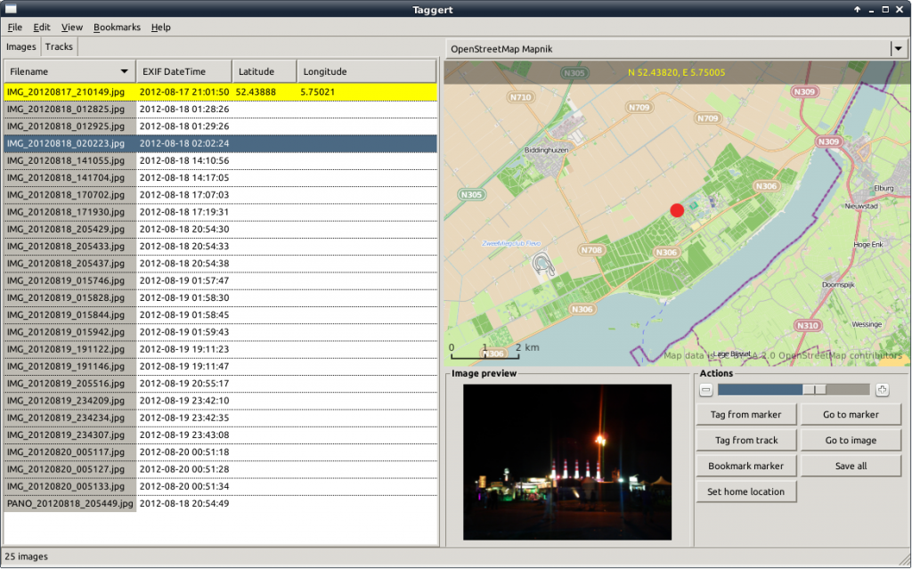
Introducing “Taggert”, a GTK+3 geotagging application
Up to now, I have been geotagging my pictures with gpsPhoto.pl, a command-line tool, that matches coordinates from GPX files with the timestamps on images. This works nicely, but it requires that you indeed have a GPX track from the time the picture was taken. For some time, I have been looking for a tool that allows me to do manual geotagging using a map.
I have found several tools that offer this functionality, or part of it. As a matter of fact, there are quite a few tools available for Windows, but I need one that runs on Linux, so I will not discuss those here. First, I found Geotag, a Java application, but it does not offer a map, so it isn’t very convenient. What I was looking for should look a lot like locr GPS Photo for Windows. This is, as the name suggests, a Windows-only tool.
Finally, I found GottenGeography, a GTK+ tool, written in Python, that does almost everything I want. Almost.
When I found GottenGeography, I had already started to explore the possibilities of writing a tool of my own, and the basis for Taggert was already there. After playing around with GottenGeography for a while, I decided I don’t like some of its design choices, and because creating a GTK+ application in Python seemed like a nice challenge, I decided to continue. And here it is: Taggert v1.0.
The README on Github explains what Taggert is, what it aims to be and how to try it out.
In short: Taggert allows add, change and remove geotags on your pictures, either manually using a marker on a map, or automatically using one of more GPX files containing GPS tracks. It allows you to store bookmarks for frequently-used locations and it supports multiple map sources, like OpenStreetMap and MapQuest.
In the near future, I hope to provide packages for different Linux distributions (at least Debian and Ubuntu). For now, you can download it from Github.
